Voted THE Best Architects & Party Wall Surveyors IN THE EAST OF ENGLAND 2024 by BUILD Magazine !
MAGAZINE Awards 2024
Do You Need A Set Of
Need Land Registry Plans Or A Lease Plan ?Order your land Registry Compliant plans from us today!
HOME /land registry compliant plans
ORDER AN Accurate Land Registry Compliant Plan TODAY
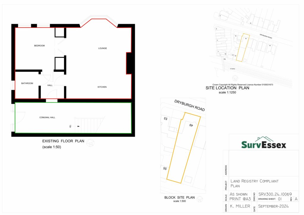
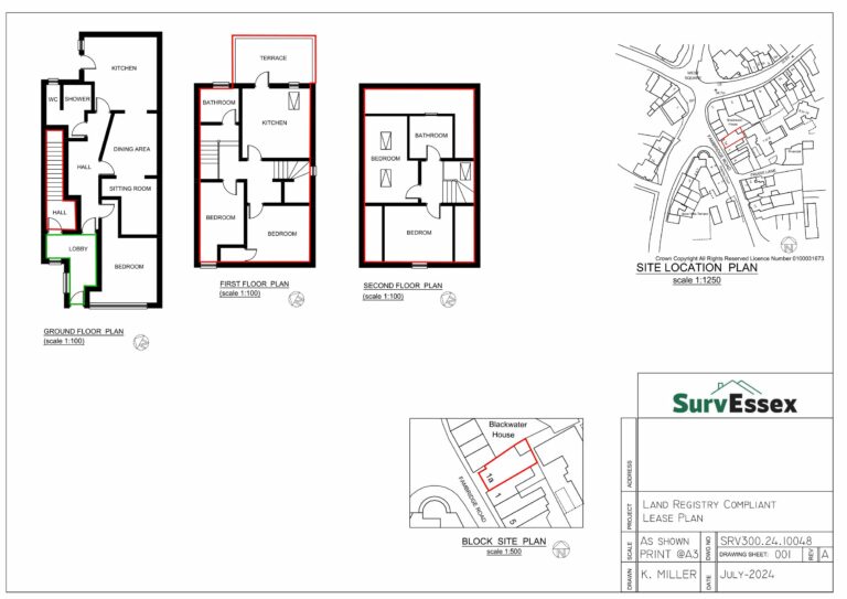
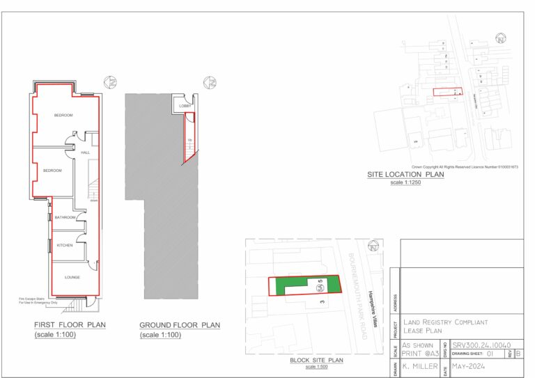
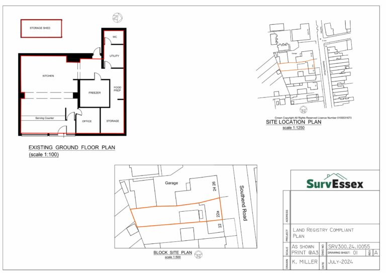
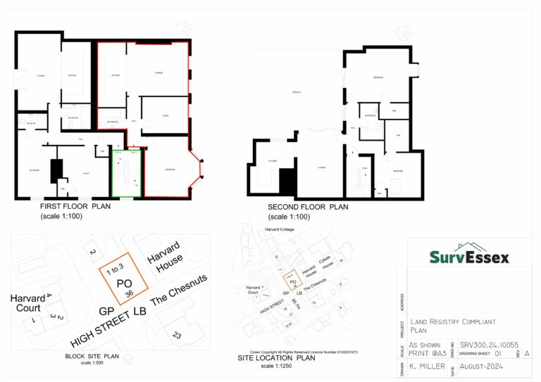
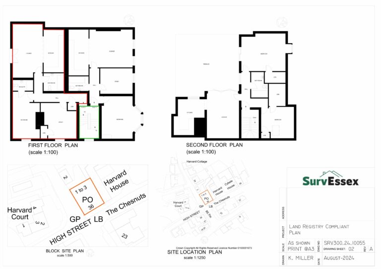
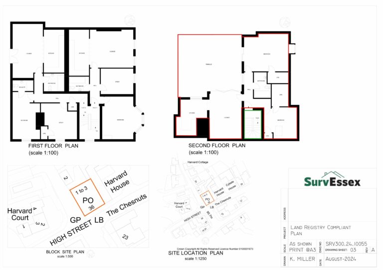
Our team at Surv Essex provides precise and compliant Land Registry Lease Plans, ensuring your property transactions proceed smoothly and quickly. Using advanced LaserSCAN technology, we deliver highly accurate plans within 2 working days. Contact us today to get started!
Compliant land registry plans
Precision and Compliance for Every Property
At Surv Essex, we specialise in creating detailed, Land Registry-compliant lease plans that meet all necessary legal requirements.
Our team combines meticulous attention to detail with the latest LaserSCAN surveying technology to ensure every plan is perfectly tailored to your needs.
We understand the urgency and importance of accurate plans in property transactions, which is why we deliver high-quality results within 2 working days.
Whether you’re a property developer, lawyer, or estate agent, you can rely on us to streamline your lease process. Our plans guarantee clarity, compliance, and peace of mind, ensuring your transactions proceed without delay or hassle.
Let Surv Essex be your trusted partner in achieving precise and compliant lease plans for your property needs.
TOTAL Precision For A Fully Compliant Plan
Experience Unmatched Accuracy with Our Advanced LaserSCAN Lease Plans
In the world of property transactions, accuracy is not just beneficial; it’s essential.
At Surv Essex, we go beyond traditional surveying methods by incorporating cutting-edge LaserSCAN technology to measure properties with unparalleled precision.
This state-of-the-art approach ensures that every corner and contour of your property is captured exactly as it is, providing flawless documentation for Land Registry purposes.
Our team is equipped with the most accurate surveying technology available in the UK, setting a new standard in lease planning and execution.
Trust Surv Essex to deliver lease plans that offer clarity, compliance, and unmatched accuracy, ensuring a seamless and efficient property transaction.
retail or commercial Lease Plans From £275.00 Including Survey
Get your property transactions moving with our efficient Lease Plans services, with full plans starting from just £275 for commercial or retail properties. We handle everything quickly and professionally, so you can focus on your next steps. Contact us today!
100% Risk Free Service
Stress-Free Lease Plans in Essex
We manage all aspects of creating Land Registry-compliant lease plans, ensuring your property transactions are smooth and hassle-free. Contact us today for peace of mind!
FIXED PRICE GUARANTEED Title Plans
Budget confidently with our Fixed Price Guarantee. Your lease plan fees are agreed up front, with no hidden costs.
Ready To Kickstart Your Project?
Get Your Free Quote Now
01375 267 277
team@survessex.co.uk
Ready to start your project? Contact us today for a no-obligation quote. We’re here to provide you with all the details you need and help you take the first step towards bringing your vision to life. Get in touch now and let’s explore how we can make your project a success!
Surv Essex Limited,
Building 13, Thames Enterprise Centre
Princess Margaret Road
East Tilbury
RM18 8RH
FAQ
Commercial or Residential Land Registry Compliant Plans In Essex
Land Registry compliant plans are detailed and accurate maps or drawings of a property that meet the specific standards set by the Land Registry. These plans are essential for the accurate registration of property boundaries, titles, and ownership. They must comply with strict guidelines to ensure that they clearly define the extent of the property, including all boundaries, buildings, and any other relevant features.
The purpose of these plans is to provide a clear and precise representation of the property, which can be used for legal purposes, such as registering ownership, transferring property, or updating title deeds. The Land Registry uses these plans to create official records that are legally binding and enforceable. Therefore, it’s crucial that the plans are accurate and compliant with the Land Registry’s requirements.
A Land Registry compliant plan is necessary whenever you need to register, transfer, or update the ownership of a property with the Land Registry. This plan is crucial for several reasons:
Legal Requirement: When registering a new property or making significant changes to an existing property, such as splitting land or merging titles, a Land Registry compliant plan is often required by law.
Accuracy of Records: These plans ensure that the property boundaries and details are accurately recorded in the Land Registry, preventing disputes over property lines and ownership.
Property Transactions: When buying, selling, or leasing property, a Land Registry compliant plan is often needed to formalize the transaction. It provides a clear and legally recognized outline of the property being transferred or leased.
Title Deeds: For properties with complex boundaries or multiple owners, a compliant plan is essential to clarify the exact details of what is included in the title deeds.
Having a Land Registry compliant plan ensures that all parties involved in a property transaction have a clear understanding of the property’s boundaries and features, reducing the risk of disputes or legal issues.
Land Registry compliant plans must meet specific requirements to be accepted for registration. These requirements include:
Scale and Accuracy: The plan must be drawn to a recognized scale, typically 1:1250 for urban areas and 1:2500 for rural areas. The scale should allow the clear identification of property boundaries and any significant features.
Ordnance Survey Base: The plan must be based on the latest Ordnance Survey map, ensuring that it accurately reflects the current landscape and property boundaries.
Clear Boundaries: All property boundaries must be clearly marked and distinguished from other features. The plan should use solid lines to indicate boundaries and include measurements where necessary.
North Arrow and Scale Bar: The plan must include a north arrow and a scale bar to provide context and ensure that the plan can be accurately interpreted.
Legibility: The plan must be clear and easy to read, with no overlapping lines or unclear markings. The use of colors or hatching can help distinguish different areas or boundaries, but these must be explained in a key.
Property Details: The plan should include all relevant details of the property, such as the location of buildings, access routes, and any rights of way. It should also include the property’s postal address and any reference numbers.
Title Number and Plan Reference: If the plan is part of a title application, it must include the title number and a reference number for the plan itself.
Meeting these requirements is essential for the plan to be accepted by the Land Registry. Non-compliant plans can result in delays or rejection of the application.
Preparing a Land Registry compliant plan involves several key steps, all aimed at ensuring the plan meets the strict standards required for registration. Here’s an overview of the process:
Site Survey: The first step is to conduct a detailed survey of the property. This may involve using modern surveying equipment, such as GPS and laser scanners, to accurately measure the property’s boundaries and features.
Ordnance Survey Base Map: The surveyor will use the latest Ordnance Survey map as the base for the plan. This ensures that the plan is aligned with the official geographic data and reflects the current layout of the land.
Drafting the Plan: Using the data collected from the survey, the surveyor will draft the plan. This includes marking all boundaries, buildings, and other significant features. The plan must be drawn to scale, typically 1:1250 or 1:2500, depending on the property’s location.
Adding Required Details: The surveyor will add necessary details to the plan, such as a north arrow, scale bar, and property details. They will ensure that the plan is clear, legible, and compliant with the Land Registry’s guidelines.
Verification: Before submitting the plan, the surveyor will verify all details to ensure accuracy. This may involve cross-referencing with existing records or conducting additional site visits.
Submission: Once the plan is complete and verified, it is submitted to the Land Registry as part of the title registration or update process.
Working with a professional surveyor experienced in preparing Land Registry compliant plans is crucial to ensure that the plan meets all necessary standards and is accepted without issues.
A title plan and a Land Registry compliant plan are both used in the property registration process, but they serve different purposes and have different characteristics:
Title Plan: A title plan is a map that shows the general location and extent of the property as it is registered with the Land Registry. It is based on Ordnance Survey data and forms part of the title deeds. The title plan provides a high-level overview of the property’s boundaries but may not include detailed measurements or specific features.
Land Registry Compliant Plan: A Land Registry compliant plan, on the other hand, is a more detailed document that meets the specific requirements set by the Land Registry for property registration or title updates. This plan includes precise measurements, clear boundary markings, and other critical details required for legal purposes.
The main difference lies in the level of detail and the purpose each plan serves. While a title plan provides a broad overview of the property, a Land Registry compliant plan offers the detail needed for accurate registration, resolving disputes, or defining complex boundaries.
Obtaining a Land Registry compliant plan for your property involves the following steps:
Hire a Professional Surveyor: The first step is to hire a qualified surveyor who specializes in preparing Land Registry compliant plans. They will have the expertise and equipment needed to conduct an accurate survey and draft a compliant plan.
Conduct a Site Survey: The surveyor will visit your property to conduct a detailed site survey. This will involve measuring the boundaries, noting the locations of buildings and other significant features, and ensuring that everything is accurately recorded.
Drafting the Plan: Based on the survey data, the surveyor will draft the plan. This includes marking all boundaries, adding necessary details like a north arrow and scale bar, and ensuring the plan is drawn to the appropriate scale.
Verification and Submission: Once the plan is drafted, the surveyor will verify its accuracy before submitting it to the Land Registry as part of your application for title registration or update.
Receiving the Compliant Plan: After submission, the Land Registry will review the plan to ensure it meets all requirements. Once approved, the plan becomes part of the official property records.
Working with a professional ensures that the process goes smoothly and that your plan is compliant with all Land Registry requirements.
A Land Registry compliant plan includes several essential elements that ensure it meets the necessary standards for property registration. These elements typically include:
Property Boundaries: The plan clearly marks the property’s boundaries, distinguishing them from other features on the map. Boundaries are usually indicated by solid lines and may include measurements.
Buildings and Structures: All buildings, structures, and significant features within the property’s boundaries are marked on the plan. This includes houses, garages, outbuildings, and any permanent fixtures.
Access Points: The plan shows all access points to the property, such as driveways, gates, and paths. If the property has shared access or rights of way, these are also included.
North Arrow and Scale Bar: A north arrow is included to indicate the orientation of the plan, and a scale bar is provided to show the scale at which the plan is drawn. Common scales are 1:1250 for urban areas and 1:2500 for rural areas.
Ordnance Survey Base: The plan is based on an Ordnance Survey map, ensuring that it accurately reflects the current landscape and property boundaries.
Property Details: The plan includes the property’s postal address, any relevant title numbers, and a reference number for the plan itself.
Other Relevant Features: Depending on the property, the plan may include additional features such as boundary walls, fences, watercourses, and easements.
These elements are all crucial for ensuring that the Land Registry compliant plan meets the necessary standards for accuracy and detail.
A Land Registry compliant plan must be prepared by a qualified professional, typically a surveyor or architect, who has experience in property surveying and is familiar with the Land Registry’s requirements. Here are some key qualifications and roles involved in preparing these plans:
Chartered Surveyors: Chartered surveyors are professionals who are regulated by professional bodies such as the Royal Institution of Chartered Surveyors (RICS). They are trained in property measurement and mapping, making them well-suited to preparing Land Registry compliant plans.
Architects: Architects with experience in property design and construction may also prepare compliant plans, particularly when the plans are part of a larger construction or development project.
Land Surveyors: Land surveyors specialize in measuring land and property boundaries. They use advanced tools such as GPS, laser scanners, and theodolites to create accurate maps and plans.
Specialist Surveying Firms: Some firms specialize in preparing Land Registry compliant plans. These firms have the expertise, tools, and experience to handle complex properties and ensure that the plans meet all legal requirements.
Choosing a qualified professional is essential to ensure that the plan is accurate, compliant, and accepted by the Land Registry.
The scale of a Land Registry compliant plan is crucial for ensuring that the property details are accurately represented. The scale chosen should be appropriate for the size and complexity of the property. The most commonly used scales are:
1:1250: This scale is typically used for properties in urban areas. It allows for a clear representation of smaller plots and detailed features such as buildings, boundaries, and access points.
1:2500: This scale is more commonly used for properties in rural areas, where the plots are larger, and less detail is required to show the extent of the property.
1:500: In some cases, a more detailed scale such as 1:500 may be used, particularly for very small properties or for plans that require a high level of detail, such as lease plans or plans showing intricate boundary details.
The chosen scale should be clearly indicated on the plan, along with a scale bar to allow for accurate measurement. The scale must be large enough to show all necessary details while still fitting the property comfortably on the page.
The Land Registry uses compliant plans to accurately record property boundaries, ownership, and other important details as part of the official property register. These plans serve several key functions:
Property Registration: When a property is registered with the Land Registry, the compliant plan is used to define the precise boundaries and extent of the property. This ensures that the property is correctly recorded in the official register.
Title Deeds: The compliant plan is attached to the title deeds of the property, providing a legal description of the property’s boundaries. This helps to prevent disputes over property lines and ensures that all parties have a clear understanding of what is included in the title.
Dispute Resolution: If a dispute arises over property boundaries or ownership, the Land Registry compliant plan is used as a reference to resolve the issue. The plan provides a clear and legally recognized outline of the property, which can be used in legal proceedings if necessary.
Property Transactions: When a property is bought, sold, or leased, the compliant plan is used to define the exact area of the property being transferred. This ensures that the transaction is accurately recorded and legally binding.
The Land Registry relies on these plans to maintain accurate and up-to-date records of all registered properties, providing legal clarity and security for property owners.
If your Land Registry compliant plan does not meet the required standards, the Land Registry will likely reject the plan, which can delay the registration or update process. Here’s what typically happens in such cases:
Notification of Rejection: The Land Registry will notify you or your surveyor that the plan does not meet their standards. They will provide specific feedback on what is wrong with the plan, such as unclear boundaries, incorrect scale, or missing details.
Revisions Required: You will need to work with your surveyor to make the necessary revisions to the plan. This may involve conducting additional surveys, redrawing boundaries, or correcting any other issues identified by the Land Registry.
Resubmission: Once the plan has been revised to meet the required standards, it can be resubmitted to the Land Registry for review. The revised plan will be checked again to ensure that all issues have been resolved.
Delays and Costs: The process of revising and resubmitting the plan can cause delays in the property registration or transaction process. There may also be additional costs associated with making the revisions, especially if new surveys are required.
To avoid these issues, it’s important to work with an experienced surveyor who understands the Land Registry’s requirements and can prepare a compliant plan from the outset.
In some cases, you may be able to use an existing site plan or survey map for Land Registry purposes, but it must meet the specific requirements for a Land Registry compliant plan. Here are the key considerations:
Accuracy: The existing plan or map must be accurate and up-to-date. It should reflect the current state of the property, including any recent changes to boundaries, buildings, or other features.
Compliance: The plan must comply with the Land Registry’s guidelines, including the appropriate scale, clear boundary markings, and other required details such as a north arrow and scale bar.
Ordnance Survey Base: The existing plan must be based on an Ordnance Survey map to ensure that it aligns with official geographic data. If the plan is not based on an Ordnance Survey map, it may not be accepted by the Land Registry.
Verification: Even if you have an existing site plan or survey map, it may still need to be verified or updated by a professional surveyor to ensure it meets all Land Registry requirements.
If your existing plan does not meet these criteria, it’s advisable to have a new Land Registry compliant plan prepared to avoid any issues with registration or legal disputes.
Preparing a Land Registry compliant plan requires careful attention to detail, and several common mistakes can lead to rejection or delays. These mistakes include:
Incorrect Scale: Using the wrong scale for the plan is a common mistake. The scale must be appropriate for the size and complexity of the property and must be clearly indicated on the plan.
Unclear Boundaries: Boundaries that are not clearly marked or that overlap with other features can cause confusion and may lead to the plan being rejected. It’s essential to use solid lines and precise measurements to define boundaries.
Missing Details: Omitting important details such as a north arrow, scale bar, or property reference numbers can result in the plan being considered incomplete and non-compliant.
Outdated Information: Using outdated data or an old Ordnance Survey map can lead to inaccuracies in the plan. The plan must reflect the current state of the property, including any recent changes.
Poor Legibility: Plans that are cluttered, poorly drawn, or difficult to read are likely to be rejected. The plan must be clear, with all features and markings easily distinguishable.
Failure to Include All Required Features: Not including all relevant features, such as buildings, access points, and easements, can result in an incomplete plan that does not meet Land Registry standards.
Lack of Professional Verification: Attempting to prepare a plan without the help of a qualified professional can lead to errors that could have been avoided. A professional surveyor will ensure that the plan meets all necessary requirements.
Avoiding these common mistakes is crucial for ensuring that your Land Registry compliant plan is accepted without issues.
The time it takes to prepare and register a Land Registry compliant plan can vary depending on several factors, including the complexity of the property and the efficiency of the professionals involved. Here’s a general timeline:
Site Survey (1-2 weeks): The surveyor will conduct a detailed site survey, which typically takes one to two weeks, depending on the size and complexity of the property.
Drafting the Plan (1-2 weeks): Once the survey is complete, the surveyor will draft the Land Registry compliant plan. This can take another one to two weeks, depending on the level of detail required.
Verification and Revisions (1 week): After drafting, the plan will be reviewed and verified. If any revisions are needed, this can add an additional week to the process.
Submission to Land Registry (1-2 weeks): Once the plan is finalized, it will be submitted to the Land Registry as part of the property registration process. The Land Registry typically takes one to two weeks to review and approve the plan.
Overall Timeline: In total, the process of preparing and registering a Land Registry compliant plan can take anywhere from four to eight weeks. This timeline can be longer if there are complications, such as the need for significant revisions or if the Land Registry requires additional information.
Working with an experienced surveyor can help streamline the process and reduce the time it takes to prepare and register the plan.
Lease plans are detailed drawings that show the layout and boundaries of a leased property. They are essential for defining the exact area covered by a lease, particularly in multi-occupancy buildings or complexes where multiple tenants occupy different parts of the same property. Lease plans must be Land Registry compliant to be accepted for the registration of leases.
Purpose of Lease Plans: Lease plans are used to clearly define the demised premises (the area being leased) within a larger property. They show the boundaries, access routes, and any shared areas such as corridors, staircases, or parking spaces.
Relation to Land Registry Compliant Plans: A lease plan must meet the same standards as any other Land Registry compliant plan. This includes being drawn to scale, clearly marking boundaries, and including necessary details such as a north arrow and scale bar. The plan must accurately reflect the leased area and its relationship to the rest of the property.
Use in Lease Registration: When registering a lease with the Land Registry, a compliant lease plan is required to ensure that the lease is properly recorded. This helps to prevent disputes between landlords and tenants over the extent of the leased premises.
Lease plans are a crucial component of the leasing process, ensuring that all parties have a clear understanding of the property’s layout and the area covered by the lease.
Yes, Land Registry compliant plans need to be updated if there are significant changes to the property that affect its boundaries, layout, or other key features. Examples of changes that would require an update to the plan include:
Building Extensions: If you add an extension to your property, the Land Registry compliant plan must be updated to reflect the new boundaries and layout.
Subdivision of Property: If the property is subdivided into smaller plots, each new plot will need its own compliant plan to accurately reflect the new boundaries.
Merging Titles: If you purchase adjoining land and wish to merge the titles, the compliant plan will need to be updated to show the new, combined boundaries.
Change in Access or Rights of Way: If there are changes to access routes, rights of way, or easements, these must be reflected in the updated plan.
Failing to update the Land Registry compliant plan when significant changes occur can lead to legal disputes and issues with property transactions. It’s important to work with a surveyor to ensure that the plan is accurate and up-to-date.
Ordnance Survey (OS) maps are the foundation for creating Land Registry compliant plans. These maps provide the official geographic data for the UK and are used as a base for accurately plotting property boundaries, features, and layouts. Here’s how they factor into the process:
Accuracy: Ordnance Survey maps are highly accurate and regularly updated, making them the most reliable base for creating Land Registry compliant plans. Using these maps ensures that the property’s boundaries are correctly aligned with official geographic data.
Scale and Detail: OS maps are available in various scales, allowing surveyors to choose the appropriate scale for the Land Registry compliant plan. This ensures that the plan is detailed enough to meet the required standards.
Base Mapping: When preparing a Land Registry compliant plan, surveyors overlay the property boundaries and features onto the Ordnance Survey base map. This provides a clear and precise representation of the property in relation to the surrounding area.
Legal Requirement: The Land Registry requires that all compliant plans be based on Ordnance Survey data to ensure consistency and accuracy in property registration.
By using Ordnance Survey maps, surveyors can create Land Registry compliant plans that are accurate, reliable, and legally recognised.
The role of a surveyor in creating Land Registry compliant plans is crucial. Surveyors are responsible for ensuring that the plan meets all the necessary standards and accurately reflects the property’s boundaries and features. Their key responsibilities include:
Conducting Site Surveys: Surveyors perform detailed site surveys to measure the property’s boundaries, note the locations of buildings, and identify any significant features. This data forms the basis of the Land Registry compliant plan.
Drafting the Plan: Using the data collected from the site survey, the surveyor drafts the Land Registry compliant plan. This involves marking boundaries, adding necessary details, and ensuring the plan is drawn to scale.
Ensuring Compliance: The surveyor ensures that the plan meets all Land Registry requirements, including accuracy, clarity, and the use of Ordnance Survey data. They verify that all necessary elements, such as a north arrow and scale bar, are included.
Resolving Issues: If there are any discrepancies or issues with the property boundaries, the surveyor will work to resolve them, either through additional surveys or by consulting with the Land Registry.
Submission: The surveyor may also handle the submission of the plan to the Land Registry as part of the registration process, ensuring that all documentation is complete and accurate.
Surveyors play a vital role in creating Land Registry compliant plans, providing the expertise and precision needed to ensure that the plan is accepted and accurately reflects the property.
The costs associated with preparing Land Registry compliant plans can vary depending on several factors, including the size and complexity of the property, the surveyor’s fees, and any additional services required. Here’s an overview of the potential costs:
Surveyor’s Fees: The primary cost is the fee charged by the surveyor for conducting the site survey and drafting the plan. This fee can vary based on the surveyor’s experience, location, and the complexity of the property. Surveyor fees typically range from £300 to £1,500 or more, depending on the scope of work.
Additional Surveys: If the property has complex boundaries or if there are disputes, additional surveys may be required, which can increase the overall cost.
Ordnance Survey Data: There may be a cost associated with purchasing up-to-date Ordnance Survey data, especially if detailed maps are required for the plan.
Legal Fees: If legal advice or services are needed, such as resolving boundary disputes or handling complex registrations, these costs will add to the overall expense.
Revisions and Resubmissions: If the plan needs to be revised and resubmitted to the Land Registry, there may be additional costs for the surveyor’s time and any new surveys required.
It’s important to obtain a detailed quote from the surveyor before starting the process to understand the full cost of preparing a Land Registry compliant plan.
The Land Registry verifies the accuracy of compliant plans through a thorough review process. This process ensures that the plan meets all required standards and accurately reflects the property’s boundaries and features. Key steps in this verification process include:
Review of Documentation: The Land Registry checks that all necessary documentation is submitted along with the plan, including any title deeds, property descriptions, and supporting information.
Comparison with Existing Records: The Land Registry compares the submitted plan with existing records and maps to ensure consistency. This includes checking that the boundaries align with the Ordnance Survey data and that there are no discrepancies.
Compliance Check: The plan is checked against the Land Registry’s guidelines to ensure it is compliant. This includes verifying the scale, clarity, and inclusion of necessary details such as a north arrow and scale bar.
Verification of Boundaries: If there are any concerns about the accuracy of the boundaries, the Land Registry may request additional information or clarification from the surveyor. In some cases, a site visit may be required to verify the boundaries.
Approval or Rejection: Once the verification process is complete, the Land Registry will either approve the plan for registration or request revisions if any issues are identified.
The verification process is essential for maintaining the accuracy and reliability of the Land Registry’s records, ensuring that all registered properties are correctly documented.
The description section of a Land Registry compliant plan provides additional context and details about the property that are not immediately apparent from the map itself. This section should include:
Property Address: The full postal address of the property, including any relevant reference numbers, such as title numbers.
Boundaries Description: A detailed description of the property boundaries, including any unique features or markers that define the boundary lines.
Access Points: Information about access routes to the property, such as driveways, paths, or rights of way, and whether they are shared with neighbouring properties.
Structures and Buildings: A description of all buildings, structures, and significant features on the property, such as garages, outbuildings, or fences.
Easements and Rights of Way: Details of any easements, rights of way, or other legal rights that affect the property, including who holds these rights.
Land Use: Information about the use of the land, such as residential, commercial, agricultural, or mixed-use, and any relevant zoning or planning restrictions.
Additional Notes: Any other relevant information that may impact the interpretation of the plan, such as recent changes to the property, planned developments, or known disputes.
Including comprehensive information in the description section helps ensure that the Land Registry compliant plan is clear and unambiguous, reducing the risk of disputes or legal issues.
Including boundaries in Land Registry compliant plans requires careful adherence to specific guidelines to ensure accuracy and clarity. Key guidelines include:
Clear Boundary Markings: Boundaries should be clearly marked using solid lines. Dashed or dotted lines may be used to indicate features such as fences or walls that are not boundary markers.
Measurements: Where possible, include measurements of boundary lengths to provide precise information about the extent of the property. Measurements should be accurate and based on the site survey data.
Use of Colour or Hatching: Different colours or hatching patterns can be used to distinguish between types of boundaries or to highlight specific areas of the property. A key should be included to explain the meaning of each colour or pattern.
Reference Points: If the boundary is defined by physical features such as walls, hedges, or fences, these should be clearly indicated on the plan. Reference points such as Ordnance Survey grid references can also be used to accurately locate boundaries.
Shared Boundaries: If the property shares boundaries with neighbouring properties, this should be clearly indicated, and any shared access points or rights of way should be noted.
Inclusion of Easements: Boundaries should take into account any easements or rights of way that affect the property. These should be clearly marked and described in the plan.
North Arrow and Scale: Include a north arrow and a scale bar on the plan to provide context and ensure that the boundaries can be accurately interpreted.
Adhering to these guidelines helps ensure that the boundaries are accurately represented in the Land Registry compliant plan, reducing the risk of disputes or confusion.
Land Registry compliant plans play a crucial role in defining and securing a property’s title and ownership. Here’s how they impact these aspects:
Defining Boundaries: The compliant plan clearly defines the property’s boundaries, which are then recorded in the Land Registry. These boundaries are legally recognized and are used to resolve any disputes over the extent of the property.
Legal Title: The compliant plan is attached to the title deeds and forms part of the official record of the property’s ownership. It provides a clear and legally binding description of what is included in the title.
Transfer of Ownership: When a property is bought, sold, or leased, the Land Registry compliant plan is used to define the exact area being transferred. This ensures that both parties have a clear understanding of the property’s extent and that the transaction is accurately recorded.
Protection of Rights: The plan also records any easements, rights of way, or other legal rights that affect the property. This ensures that these rights are protected and recognized in any future transactions.
Dispute Resolution: If a dispute arises over property boundaries or ownership, the Land Registry compliant plan is used as the primary reference to resolve the issue. The plan’s accuracy and clarity are essential for providing legal clarity and preventing or resolving disputes.
By providing a clear and accurate record of the property’s boundaries and features, Land Registry compliant plans help to secure the property’s title and protect the owner’s rights.
If your property’s Land Registry plan is rejected, it’s important to take the necessary steps to address the issues and resubmit the plan. Here’s what you should do:
Review the Rejection Notice: The Land Registry will provide a rejection notice outlining the reasons why the plan was not accepted. Carefully review this notice to understand what needs to be corrected.
Consult with Your Surveyor: Contact the surveyor who prepared the plan and discuss the reasons for the rejection. The surveyor will be able to explain the issues and suggest the necessary revisions.
Make the Necessary Revisions: Work with your surveyor to make the required revisions to the plan. This may involve conducting additional surveys, redrawing boundaries, or correcting any other issues identified by the Land Registry.
Resubmit the Plan: Once the revisions are complete, resubmit the plan to the Land Registry along with any additional documentation required. Ensure that all issues have been addressed to avoid further delays.
Follow Up: After resubmitting the plan, follow up with the Land Registry to ensure that the revised plan is being processed. If there are any further issues, address them promptly with the help of your surveyor.
Addressing the issues quickly and thoroughly will help ensure that your plan is accepted and that your property registration or transaction can proceed without further delays.
Yes, Land Registry compliant plans can be submitted online through the Land Registry’s online portal. This service is designed to streamline the submission process and reduce the time it takes to register property transactions. Here’s how it works:
Preparation: Before submitting the plan online, ensure that it is compliant with all Land Registry requirements. The plan should be in an acceptable digital format, such as PDF or TIFF.
Online Portal: Access the Land Registry’s online portal and follow the instructions for submitting a plan. You’ll need to provide details about the property, upload the compliant plan, and complete any additional forms required.
Submission Confirmation: Once the plan is submitted, you’ll receive a confirmation of submission from the Land Registry. This confirmation will include a reference number that you can use to track the progress of your application.
Review and Approval: The Land Registry will review the submitted plan to ensure it meets all necessary standards. If the plan is accepted, it will be added to the property’s title record. If any issues are identified, you’ll be notified and asked to make revisions.
Submitting plans online is a convenient and efficient way to handle property registrations, especially for professionals who need to manage multiple transactions.